Project Aim
The aim of BurVal has been to deliver knowledge and understanding of the structural and hydrological properties of deeper groundwater resources found in buried valleys. This led to the development of spatial planning strategies that take these ancient groundwater reservoirs into account and ensure a sustainable fresh water resource management.
Project implementation and results
Pilot projects
As a main outcome, 6 pilot projects have been carried out in the participating areas where groundwater quality and quantity were evaluated. The results have been used as input for the development of geophysical methods and a model for exploration and examination of groundwater resources. These methods have provided useful insights, once evaluating different spatial development scenarios.
The implementation sites in Hamburg and Schleswig-Holstein, where two waterworks started in 2007 in order to use the geological 3D model to produce a groundwater flow model to optimise the water extraction from the catchments areas will need some time to take effect.
Spatial development
On the basis of the improved understanding gained through the project, action plans and recommendations have been developed. The results are summarised in the book "Groundwater Resources in Buried Valleys - a Challenge for Geosciences". It includes a 'technical part' as well as a 'planning part'. The book addresses experts on the one hand and decision makers, spatial planners, waterworks and public authorities on the other.
Joint transnational strategy
Mode of cooperation
The co-operation of several scientific institutes and public authorities in Denmark, Germany and the Netherlands have supported both knowledge transfer between the concerned North Sea regions and established future European drinking water policies.
The BurVal project has had close links and co-operation with the BRIDGE project within the EC Sixth Framework Programme on Research and Development. The BurVal project has provided important data on how to derive groundwater threshold values for selected trace elements and thus evaluated the groundwater chemical status based on these data, in accordance with the EU Water Framework Directive and the new Groundwater Directive (approved in December 2006).
Impact of the project
Long-term achievements
The conducted geophysical and geological mapping, which was performed in the project, will be used in the delineation of groundwater bodies as requested by the Water Framework Directive and in evaluation of the 3D structure of the subsurface, which is important for the spatial planning in the investigated regions and evaluation of the compliance with the EU directives.
Policy shaping
The issues associated with sustainable fresh water use are important in the European agenda. The project has provided an important insight in this aspect and presents an interesting link between academic research and end user applicability of the research results.
Dissemination
The international technical and scientific community was also involved in the project, in particular in the dissemination of the results through publication in technical and scientific journals. The BurVal book can be downloaded from the project website. |

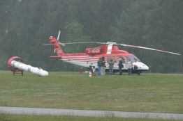
Geophysical and geological mapping, Fieldwork in Ellerbek (DE)
Partners Vejle County, DK
Ringkjøbing County Council, DK
Sønderjylland Municipality, DK
Ministry of the Environment, DK
LANU, Landesamt für Natur und Umwelt Schleswig-Holstein, DE
BGR, Bundesanstalt für Geowissenschaften und Rohstoffe, DE
Umweltbehörde Hamburg, BUG, DE
TNO-NITG, National Geological Survey, NL
LP:
Leibniz Institute for Applied Geosciences, GGA-Institut
Project Manager
Helga Wiederhold
Leibniz Institute for Applied Geosciences, GGA-Institut Stilleweg 2
D-30655 Hannover
Germany
helga.wiederhold@gga-hannover.de
www.burval.org
Tel: +49 511 643 3520
Measure: 4.1
Start Date: 30 September 2003
End Date: 31 December 2006
ERDF Grant:
 1.354.026,50 1.354.026,50
Total Eligible Sum:
 2.708.053,00 2.708.053,00
|